MONITORING WILD ELEPHANT MOVEMENT, WWF INSTALLS GPS COLLAR IN TANGGAMUS LAMPUNG
By: Hijrah Nasir
As an umbrella species, the role of elephants is enormous in maintaining biodiversity and ecological integrity in their ecosystems that help save various other smaller species.
Elephants have a very large home range of up to 20 square kilometers per day and consume about 180 liters of water and 150 - 300 kg of food per day. With this vast range, the plant seeds in the elephant's feces will be scattered throughout the forest area that it explores which will help the natural regeneration process of the forest.
However, the elephant population is expected to decline every year. Habitat fragmentation and shrinkage contribute greatly to this rate of population decline. This is compounded by high rates of elephant poaching and trafficking as well as human-elephant conflicts that occur in villages bordering conservation areas. Habitat shrinkage and food depletion often force Sumatran elephants to visit community plantations, triggering human-elephant conflicts that result in elephant deaths and economic losses for communities. This is also the case around the TNBBS area and Protected Forest KPH IX Kota Agung Utara, Tanggamus Regency, Lampung Province. Conflicts occur because elephants lose their natural habitat and food, which has undergone land conversion into coffee plantations and settlements.
The protected forest area of KPH IX Kota Agung Utara, which functions as a buffer area for the TNBBS area, has experienced very high degradation of forest conversion over the past few decades. Part of the area has now been converted into coffee, chocolate, banana and pepper plantations, reducing the carrying capacity of the ecosystem for wildlife habitats including elephants to live, move and find their natural food. These conditions have caused wild elephants to move out of their habitat and resulted in human-wild elephant conflicts that have been going on since July 2017 and have caused huge losses to the community in 6 villages in Semaka Subdistrict, Tanggamus Regency.
Since the conflict occurred, various efforts have been made, such as herding and blocking at the boundary between the community area and the protected forest area of KPH IX Kota Agung Utara to the area bordering TNBBS. However, these efforts have not been effective in preventing elephants from returning to plantation areas and community settlements. This proves that the capacity of natural habitat for elephants in TNBBS and HL areas is decreasing and narrowing, especially in providing food, water and minerals. Therefore, the WWF team realized the need to analyze the use of habitat by wild elephants in the area using GPS collars so that they could determine the areas that are still used by wild elephants to live, move, and find food. The results of this analysis will later be used as the basis for management policies for the government in maintaining the habitat.
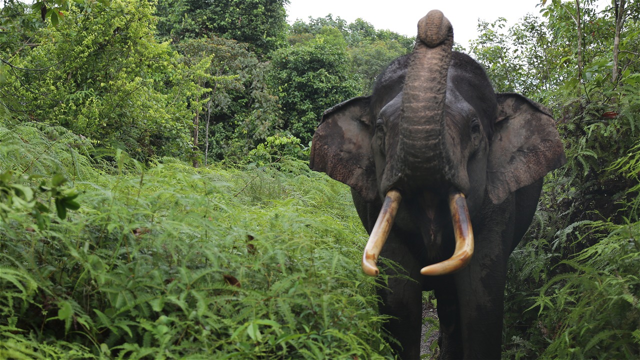
WWF together with the TNBBS Center, TNWK Center, Bengkulu - Lampung BKSDA, Green Valley Wildlife Park, ILEU-YABI, Mahout Elephant Patrol (EP) Pemerihan and the community installed the GPS Collar on Wednesday, April 4, 2018 at 19:05 WIB in the cultivated land area of the Talang Sido Rahayu Block 5 Protected Forest register 39 KPH IX Kota Agung Utara. The series of GPS Collar installation process lasted for 5 days from April 2 to 6, 2018.
The GPS Collar is attached to an individual adult female elephant (dominant) in the form of a necklace that can transmit coordinate points to satellites and computer devices. The coordinates will then be analyzed using an application to produce data in the form of a map of elephant distribution and home range. This includes the movement paths and exit points of elephants into gardens and settlements. Using this information, the team can find out the home range and movement of Sumatran elephant groups in TNBBS and Protected Forest KPH IX Kota Agung Utara, build an early warning system as an effort to mitigate conflicts between humans and wild elephants, find out the portion of habitat use of wild elephant groups in TNBBS and Protected Forest KPH IX Kota Agung Utara, and as input for the management of Sumatran elephant habitat in TNBBS and Protected Forest KPH IX Kota Agung Utara.
GPS Collar installation begins with monitoring the position of wild elephant groups and identifying dominant individuals (group leaders). Then anesthesia is carried out on the dominant elephant (target), when the anesthetic effect has worked then the GPS Collar is installed. After the installation, the WWF Team and Mahout EP Pemerihan still conduct monitoring at the location to ensure that the GPS Collar is well installed and comfortable for the elephant. In addition, monitoring is also carried out to ensure that the individual elephant has returned to normal activities as usual and joined the group. The installation of the GPS Collar is expected to contribute to the management of the conservation area to avoid human-elephant conflict in the area.
The GPS Collar is the result of a fundraising campaign initiated by musician Tulus with the theme "Don't Kill Elephants". Through the tagline #janganbunuhgajah, singer Tulus continues to voice elephant conservation and successfully garners support from the public. This plays an important role in Sumatran elephant conservation efforts. It's time for the public to take part in efforts to conserve Sumatran elephants so that their existence in nature is maintained.


