WWF-INDONESIA ADOPTING ANDROID TECHNOLOGY ON THEIR COASTAL RESOURCES MANAGEMENT PLANNING
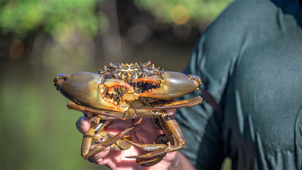
Nowadays mapping is gettingeasier to do. By downloading Open Data Kit (ODK), the data-based application,through an app store such as Google Play, the mapping can be performed. WWF-Indonesia, together with TAKA, conducted mud crab (mangrove crab) utilization activity mapping in Pemalang on 26 – 28 December 2013 by usingthird party application provided by Android Operating System for free. Local fisherman group (Kelompok Nelayan Kepiting Lestari) also joined the activity in identifying fishing, landing, and marketing sites, as well as the key habitats of the three mangrove crab species mainly targeted on fishing activities, namely Scyllaserrata, S.paramamosain, and S.olivacea..
Mangrove ecosystems in Pemalang can be a good example of mangrove conservation, tourism, and integrated effort in maintaining the populations of mangrove crabs in the northern coast of this district. Mapping technique by using android-based application can result in reliable maps essential for sustainable management of mangrove crabs in Pemalang, where TAKA is theorganization that performs direct facilitation on the field. After the collection of spatial data and some biology-related information of mangrove crab, the next step is the development of mangrove crab management plan to ensure the sustainability of the crab stocks in Pemalanng in collaboration with researches from University of Dipenonegoro. .
Android is one of the operating systems widely adopted by mobile devices such as smartphones and tablet computers. It keeps increasing its capacity to satisfy its users by providing many useful third party applications, one of which is an application that supports mapping activities and can also be usefull for coastal and marine resources management plan. “Android-based devices are largely used by many people these days, where loads of third party applications can be downloaded freely such as mapping apps. It gives us a better opportunity of resources management,” Abdullah Habibi, Capture Fisheries Coordinator, WWF-Indonesia, explained. He also added that the success story of habitat and key site mapping in Pemalang was a proof that mapping could be done with a simple technique that did not cost a lot of money, and this method could also be implemented by other members of JARING Nusantara later on.
For Further information please contact Abdullah Habibi, National Capture Fisheries Coordinator, WWF-Indonesia, email : AHabibi@wwf.or.id
JARING NUSANTARA emerged on February 2013, is the coalition of Indonesian local NGOs and fishermen groups aiming to promote sustainable fisheries products in Indonesia under the standard of seafood ecolables, MSC (Marine Stewardship Council) for capture fisheries and ASC (Aquaculture Stewardship Council) for Aquaculture.
YAYASAN TAKA
TAKA is a non-profit organization promoting marine conservation. From 2000 – 2005, TAKA’s programs were designed to support rezoning Karimun Jawa National Park (Taman Nasional Karimun Jawa/BTNKJ). After successfully completing its previous program, from 2006 to recent years TAKA has been developing several programs to support the sustainability of marine resources and to ensure the prosperity of coastal communities in Indonesia.


