DATA-DRUNK EXPEDITION
Author: Terry Endropoetro (travel blogger http://negerisendiri.com/2016/web/)
Collecting data was very important during #XPDCKOON at 20 dive sites in Gorom, Panjang, Koon, Grogos, Geser, Neiden, and Nukus Islands, East Seram Regency. WWF-Indonesia's Menami boat became our 'home'. A place to bathe, rest, fill your stomach, and of course collect data.
There are 4 dive points within the Koon Marine Protected Area (MPA) (the waters of Koon Island, Grogos, Nukus, and east of Neiden) with the coordinates of the dive points that must be precise, because they are last year's monitoring points and the data taken this year will be a comparison with the data taken last year. While the other 16 dive points are initial data collection within the conservation area and outside the conservation area.
A team of 13 divers consisting of members of the East Seram Marine & Fisheries Service, Wakatobi National Park Center, Ambon Navy, WWF-Indonesia, Terangi Foundation (Terumbu Karang Indonesia), and bloggers who were then divided into 2 teams. Two boats were tied to the side of the Menami. The rubber boat is used by one team for dive points that are at most 5 kilometers away, the speed boat has to reach dive points that reach 15 kilometers away from the Menami boat.
During the 5-day expedition, each dive team made 2-4 dives each day. Leaving early in the morning, going back and forth from the dive points to WWF-Indonesia's Menami ship to rest and refill the tubes, was included in the tight schedule of this expedition. Luckily the weather was favorable, only a few times heavy rain fell, but the dives continued after the rain stopped.
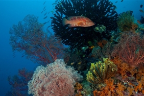
Each diver carries a piece of paper with data that must be recorded during the dive. Starting from the brightness of the water, the shape of the growth of benthic categories, the type and abundance of reef fish, current speed, as well as the depth of the coral reef. In addition, the type of reef, the type and degree of slope where the coral reef grows, and the degree of slope, the position of the coral and the visibility of the diver towards the coral are also recorded. Not only corals, the dive team must also remember the types of fish they saw as well as their size.
After each dive, the data sheets must be collected immediately so that they are not lost in the wind. Funnily enough, one diver even lost a data sheet during a dive, it was untied and washed away. There is actually an android application that uses the GPS system. Besides being able to be used in places where there is no phone signal, this app saves paper, reduces errors, and also prevents data loss. Unfortunately, this application cannot be used in diving because there are no smart phones that can be used underwater.
After dinner, all members of the dive team usually go upstairs on the Menami boat. While enduring drowsiness and enduring a tired body. They input data and select the hundreds of photos they took during their morning to afternoon dives. They usually go to bed around midnight, then wake up early in the morning to re-prepare their diving equipment. Seeing how serious they are, I can't help but be amazed and proud of how devoted they are to Indonesia's underwater treasures.

