KEI BESAR 3RD EXPEDITION: OHOI LEROHOILIM, BEACH SAND SASI AND NEW TOURISM POTENTIAL
By Christian Novia N.H
Do you still remember an ohoi in Kei Besar named Lerohoilim? Ohoi Lerohoilim is one of ohoi that was visited by the Kei Besar expedition team last November. Lerohoilim is located in the western part of Kei Besar Island in Southeast Maluku District, around 6 km from Elat, the capital of Kei Besar Subdistrict. The transportation to Lerohoilim could be reached with public buses or motorcycle for 20 minutes.
Lerohoilim also have a local territory which covers four villages (Ohoi soa) and one main village (Ohoi Orang Kai). Those Ohoi Soa areKarkarit, Daftel, Udar and Harangur. According to local people, this what has made them called Lerohoilim or the sun of five villages. In the coastal area, this local territory is bordered with Ohoi Werka in Batu Putih Cape, and directly bordered with Ohoi Elat in Kelapa Island.
This village is divided into two areas, upper village and lower village. The upper village is located futher upland than the other village. The upper village consists of Karkarit, Daftel and Lerohoilim, whereas the lower village consists of Udar and Harangur. Most of the upper village residents are christian while the lower village mostly consists of Muslims. Although they have different belief, they have always been living in harmony. This could be seen from the group discussion conducted when the expedition team visited the area. Both villages were actively complemented each other to answer the questions given from the expedition team.
most of the residents in Lerohoilim are farmers. Farms are abundantly scattered around the village with various products such as banana, embal (cassava flour), corn, cassava and yam. The people fish usually just for their own consumption, not for making incomes, and is strictly limited to adjacent coral reef area. The locals usually fish or collect marine biotas such as clams, sea cucumber and seagrass. This activity is commonly called “bameti” which can be done by both the men and women. Although most of the people are farmers, but this village has represented Maluku Province in National level on 2010 in POKMASWAS (Environmental Watch Group). Unfortunately, this achievement could not be continued due to lack of fund and facilities, but the impact can still be seen until today.
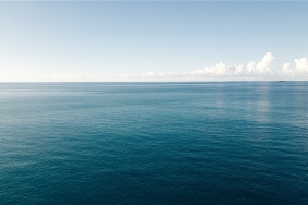
The clean and white sand beaches of Lerohoilim is the only village in western coast of Kei Besar that serves as a toursim destination for local people. A 1.7 kilometer stretch of beach is an important asset for the people of Lerohoilim, therefore they agreed to establish a sasi regulation towards the beach’s sand. The reason behind this is because the sand has been mined for years and has caused abration.
According to the local, a group of tourists from Netherland, France and Italy has been periodically coming to Lerohoilim for vacation. These groups of tourists usually would live in local’s hourse for two to three days. They use paddle boats to swi or snorkling in the adjacent reefs. But nowadays the tourists have complained the bad reef condition.
The team then continued to conduct a manta tow along Petuanan Lerohoilim. The result shows that most of the coral reef in the area is already degraded, but in some areas the reef still has high reef coverage (>55%) like in front of Kampung Besar (Lerohoilim), Tanjung Elat and western part of Pulau Kelapa. The result is hopefully could spur the local communities to begin protect the remaining coral reef in their respective areas. Apparently there area still some areas that are still producing planulas into the surrounding reefs, and for one, that is a good news.
Translated by Imanda Pradana