DAY 8-9 – ROUNDING UP THE ALOR ISLANDS
by Nara Wisesa
I must’ve been exhausted from my first dive yesterday.When I woke up, it was already 7, and we were already in our next site, back on the west coast of Pantar Island, but much further south from yesterday’s sites. I was told to get ready to join the team for the first dive of the day (and my second dive in the expedition). This time I joined team B, and buddied Tano, I watched him on how to keep composure, follow the transect, and collect benthic data, my buoyancy control is starting to get better (much better than yesterday, anyway). At times, we experienced pretty strong current at the dive site, but the troublesome part is that the current keeps switching direction, at one moment it was pushing us from behind, and a few minutes later it comes from the front.This was my first real experience with current in Alor, so it took some time for me to get used to it. Before the dive, I brought an underwater notepad, planning to start learning to take data,however, I was not yet able to. Once we’re back on board the Menami, Team A told us that they encountered a couple of whitetip reef sharks in their dive site.
After finishing our dive in Pantar, the Menami continued sailing towards Kangge, an island west of Pantar. This island is very picturesque, with green fields of grass and scattered trees, beautiful limestone coasts and boulders, and the water around it is crystal clear, showing the shallow sands and reef patches beneath. Though given the island’s position at the strait between Pantar and Lembata, the surface current was very strong. Time and again even the Menami struggled to sail through the current. The teams managed to find locations where the bottom current were much friendlier, but the surface current was still threatening, and after the team members finished the dive, they had to hold on to the location buoys to stop themselves from being washed away, or wait beneath the current until the dinghy came to pick them up. Meanwhile on board the Menami, as we wait for the teams to return, we saw a large green turtle resting for almost five minutes on the surface only a few meters left of the ship, maybe it’s using the ship’s lee-side as a shelter from the current.
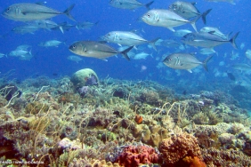
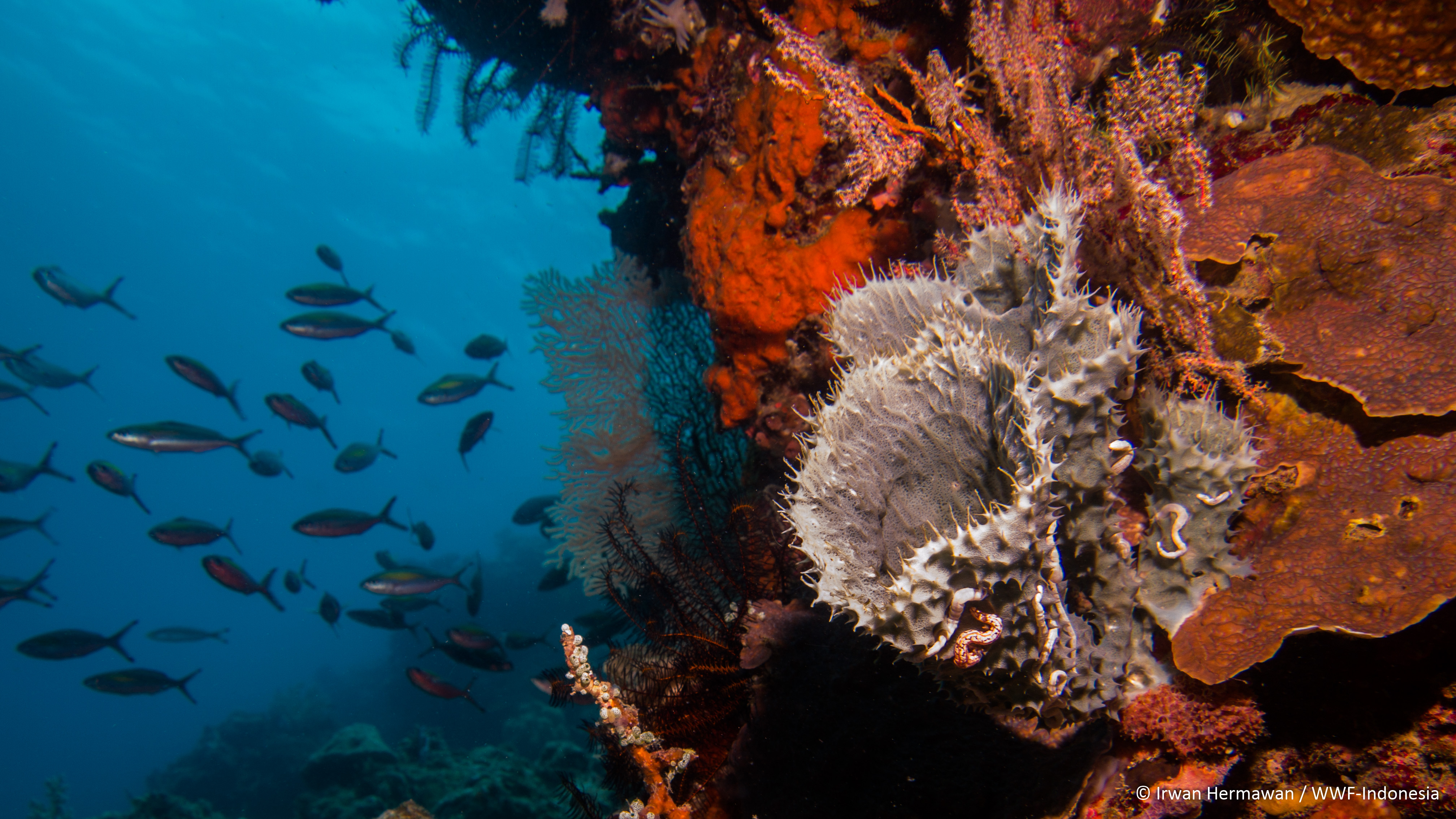
Our next stop was called PulauKambing (Goat Island), a small island south of Kangge. To reach the island we also had to brave the currents once more. We encountered a number of gyres on the way, the ship’s crew even said that it’s as if we’re sailing up-river and not in the sea. In addition to the currents, we were also challenged by high waves in trying to find suitable sampling site around the island. Team A decided to dive not far from the Menami, where the waves are a bit calmer. I joined team B to dive further away, we braved the waves until we reach a sheltered bay. Our decision to dive here paid off handsomely as the reef below is in good condition, with plenty of fishes. The fish surveyors even saw a number of giant trevallies taking shelter in the bay. Indeed our DKP partners told us that before the area was designated as a core zone, sports fishermen often go here to catch large fishes. I also managed to collect my first set of benthic data, the current was minimum and I was able to follow Tano. Data collection underwater is much harder than it seemed!! I was only able to collect data for 1 transect before I realized that I was left behind quite far, so I decided to swim and catch up with Tano first before I continued collecting data. In general I am starting to be able to differentiate the coral life forms (also much harder to do underwater), I noticed that most of the coral growing here are encrusting, submassive, and mushroom corals, indicating that the disturbance in this area, either due to wave action or current, is quite high, preventing branching and table corals from growing to large sizes. On the way towards our dive site, we also saw the namesake of this island, a few goats can be seen grazing in the grass fields not far from our sampling site. The dinghy decided to wait for us at that bay, when we finished and came back to pick up team A, we found them already waiting on the beach near their sampling area. Turns out that the current became too strong at their site, that they only managed to do 4 transects and had to call off their longswim survey.
As we finished the dive in PulauKambing (Goat Island), we continued sailing towards PulauRusa (Deer Island), a larger island which is located west ofPulauKambing. As we arrived here, it was already close to 5 PM, so we decided to lay our anchor and dive first thing in the morning. That afternoon, we convinced the captain to allow us to use the dinghy and visit the pristine white sands of the beach of PulauRusa. Pak Mus came along with us. After our compulsory beach photo session with our expedition banner, we spread all over the beach to enjoy the scenery and the setting sun. We also saw tracks on the sand, belonging to the namesakes of this island (deers). When the dinghy picked us up, the waves have also picked up, and the dinghy had trouble reaching the shores! Luckily it managed to ride one large wave, and all of us scrambled to climb aboard. The short ride back to the Menami was also rough, and we ended up soaked from head to toe by a large wave! Luckily tutus managed to shield his camera on time and it didn’t get soaked. The night we spent on the shores of PulauRusa was uneventful, but unproductive. Due to the large waves, most of the team got dizzy and a bit seasick, while others (including me) relate to the experience to being in a cradle. Needless to say I slept early and very soundly that night! The next morning, the team made their dives at PulauRusa, the condition here is similar to the conditions in the areas we dived yesterday, the corals are relatively good although there were minor damages observed. The current was not so strong, as the team did their dives during slack tide.
After we finished our dive at PulauRusa, we returned to the southern coast of Pantar to do one more dive, at a cape called TanjungSoyang. It turns out the current in the area was extreme, and the team only managed to find one location feasible to be sampled. So both teams dived together, with one team collecting data, while some members of the other team serving as buddies, while the rest stayed at the surface. Once the teams are onboard the Menami, we cheered the end of the Alor leg of this expedition! And we bid farewell to the troubles that plagued the early part of the expedition, may it be left behind and no more problems will befall us in Flores Timur.
Menami then set off towards Flores Timur, using the southern route, passing the southern coast of Lembata Island. The southern route was chosen as at the moment, wind conditions make the northern route more perilous, as we experienced back in our second day. The southern route is known as the whale-watching route, due to the high frequency of sperm whales observed south of Lembata. Knowing this, we were on guard throughout the journey, keeping a keen eye around the ship trying to spot any blows that might indicate the presence of a sperm whale. Unfortunately by the time the sun sets, we haven’t seen a single sperm whale, though we did came across a number of dolphin pods, one of which bow rides in front of the Menami (possibly spinner dolphins). I also saw some larger dolphins in the distance, when seen through the binoculars I noticed that their dorsal fins are large with a round overhanging lobe on top, indicating that they are possibly pilot whales. We later arrived safely in the Larantuka fisheries harbor safely at around 10 PM. Farewell Alor! Hello East Flores!