ALIGNING SCIENTIFIC DATA AND THE UTILIZATION OF MARINE SPACE AS KEYS TO THE DEVELOPMENT OF SMALL-SCALE FISHERIES IN SOUTHERN JAVA, BALI, AND NTT
The offshore waters stretching from southern Java, through Bali, to East Nusa Tenggara are one of the most important marine regions in Indonesia. One reason for this is the phenomenon of upwelling, a natural process in which nutrient-rich seawater rises from the seafloor to the surface. These nutrients make the waters extremely fertile, providing abundant food for various fish species, such as skipjack, albacore, mackerel, and tuna. That is why this region has become one of Indonesia’s key fishing hubs, with a potential fish resource of over 1.3 million metric tons per year (Directorate of Fish Resources, 2026). Not only is it rich in fish, but this region of the Indian Ocean also serves as a vital migration route for various charismatic marine species—such as sharks, whales, and sea turtles—that traverse Indonesian waters every year.
Given the high ecological value of this region, the offshore waters from southern Java, through Bali, to East Nusa Tenggara are being designated as Large-scale Marine Protected Areas (LSMPA). Unlike typical marine conservation areas, the LSMPA is designed to protect vast marine areas, encompassing the open ocean, the water column from the surface to a certain depth, and deep-sea ecosystems. This initiative is part of Indonesia’s efforts to achieve the target of protecting 30 percent of its national jurisdictional waters by 2045. In addition to preserving biodiversity in the deep sea, the implementation of LSMPA is also expected to help restore fish stocks so that the benefits can be felt by surrounding fishing communities.Despite its great potential, the development of Large-scale Marine Protected Areas (LSMPA) in this region still faces challenges, primarily due to the limited scientific data that integrates information on marine biodiversity and oceanographic conditions. These data limitations prevent researchers and area managers from fully understanding the characteristics of deep-sea habitats and the ecological processes occurring within them. Consequently, developing science-based conservation plans—including determining effective area designs and management strategies—becomes more difficult. Therefore, integrating various scientific data is a crucial step to ensure that conservation areas truly reflect on-the-ground ecological conditions. A robust database is also necessary to enable more accurate decision-making and ensure consistent area management—from the planning, designation, and implementation stages through to monitoring.”“Currently, conservation areas in the open ocean remain underrepresented, so there is still a great deal of research needed that we must conduct to support the designation of LSMPA areas,” said Achmad Mustofa, Sustainable Fisheries and Aquaculture Lead at WWF-Indonesia. “Of course, aligning the study results with fisheries utilization, trade routes, oil and gas resources, and other factors is necessary to reach objective and robust conclusions.”
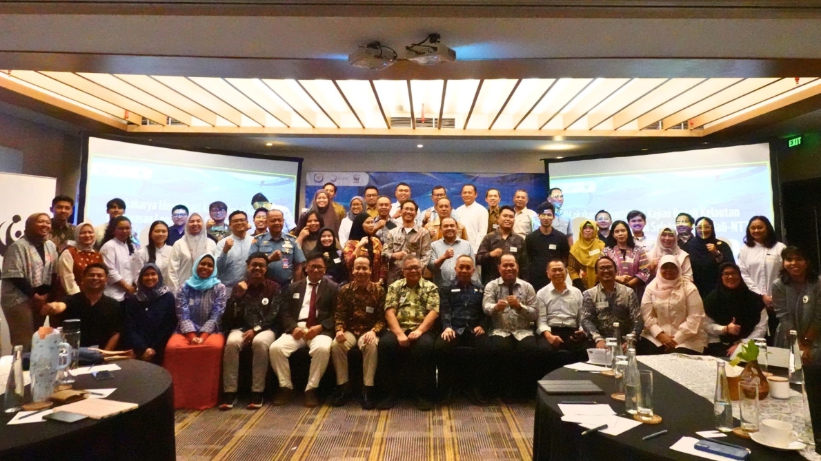
To support these efforts, WWF-Indonesia brought together various marine experts at the Marine Scientific Research Workshop for the development of LSMPA areas in the regions of Southern Java, Bali, and East Nusa Tenggara (NTT). The event, held on June 22–23 in Kuta, Bali, aimed to strengthen the scientific foundation for conservation area planning. The workshop was made possible with support from Blue Nature Alliance (BNA), a global partnership that promotes the accelerated establishment of offshore marine protected areas in Indonesia.
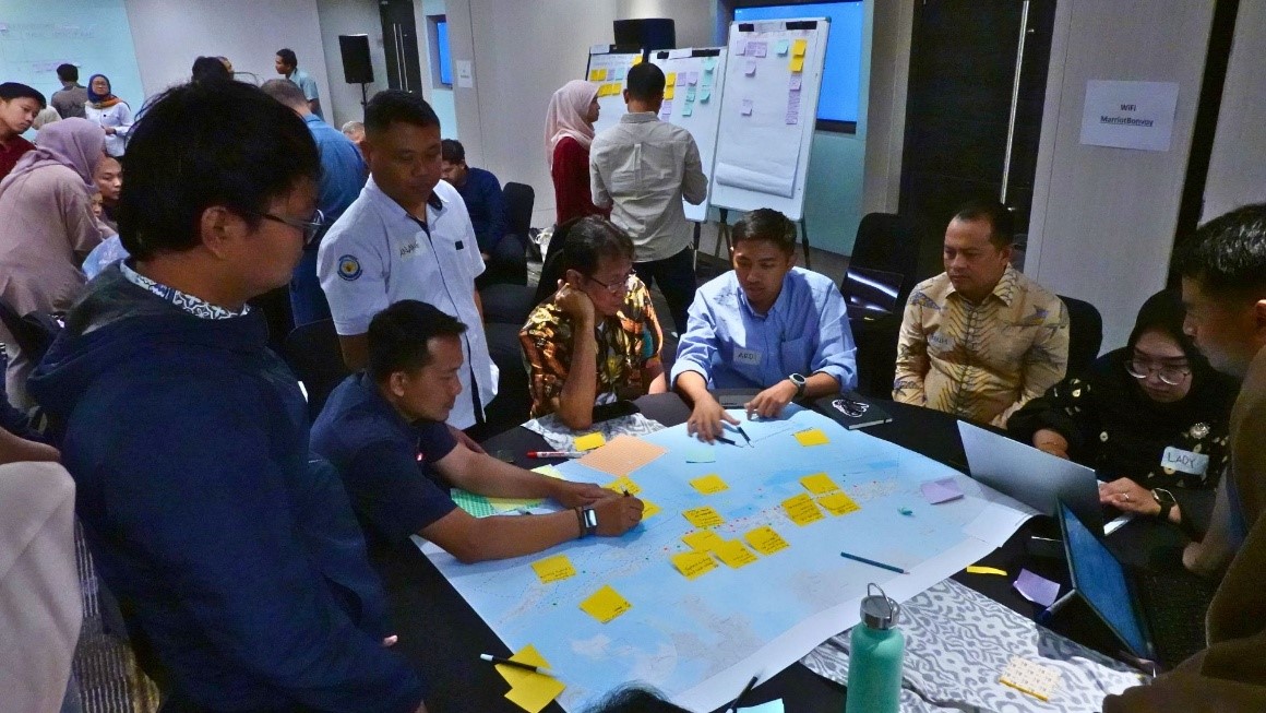
Over the course of two days, this workshop was attended by 55 participants, including experts from various universities along the southern coast of Java through to East Nusa Tenggara, researchers from the National Research and Innovation Agency (BRIN), representatives from provincial Marine and Fisheries Agencies (DKP), OceanX, and various conservation partner organizations. Participants collaborated to gather diverse scientific perspectives, identify data needs, and map information gaps that still need to be addressed in the development of the LSMPA. The data prioritized for study covers aspects of oceanography, biodiversity, fisheries, as well as socioeconomic factors and governance. All of this data will subsequently be integrated through a multidisciplinary approach to produce a more comprehensive understanding that will serve as the scientific foundation for the planning and development of the LSMPA.
The need for comprehensive data serves as a crucial foundation for the development of LSMPA, given that this area is designed as a marine management tool that maintains ecological connectivity and strengthens ecosystem resilience against climate change, overfishing (overfishing), and environmental degradation.
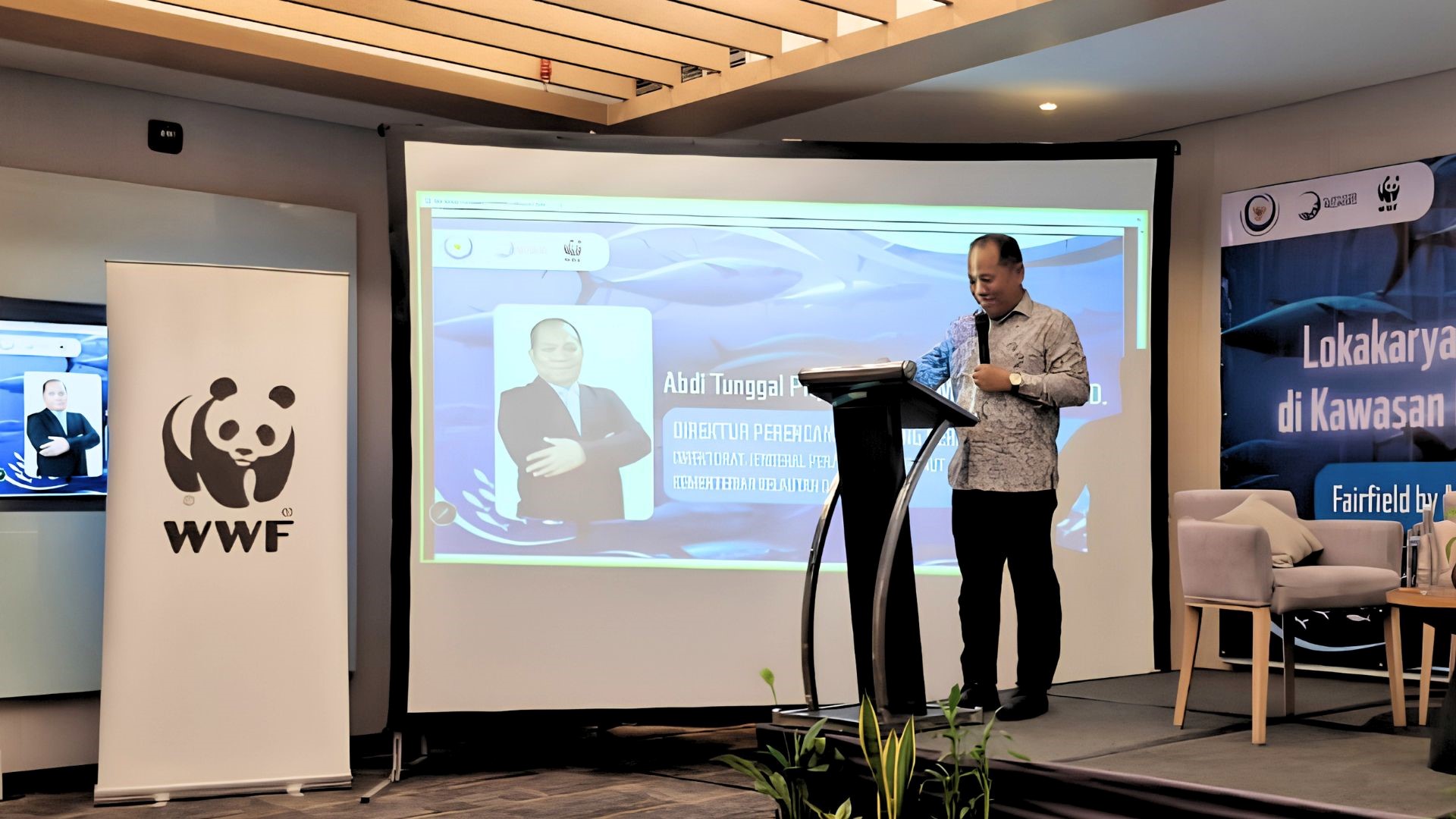
“This area defines what we must protect, but marine spatial planning determines how we ensure its sustainability within an integrated marine spatial system,” said Abdi Tunggal Priyanto, Director of Marine Spatial Planning at the Ministry of Marine Affairs and Fisheries.
The development of LSMPA is not intended to replace existing coastal conservation areas. According to the Director of Ecosystem Conservation at the Ministry of Marine Affairs and Fisheries (KKP), Firdaus Agung, LSMPA and MPAs serve different yet complementary functions. Both need to be managed and must provide tangible benefits to the community while supporting regional and national development.
The importance of cross-stakeholder collaboration was also highlighted during this workshop. The Head of the Bali Provincial Marine Affairs and Fisheries Agency, Putu Sumardiana, believes that synergy among the government, academics, research institutions, civil society organizations, and development partners is key to producing high-quality scientific data while strengthening cross-sectoral, cross-regional, and interdisciplinary collaboration in support of sustainable marine space management.
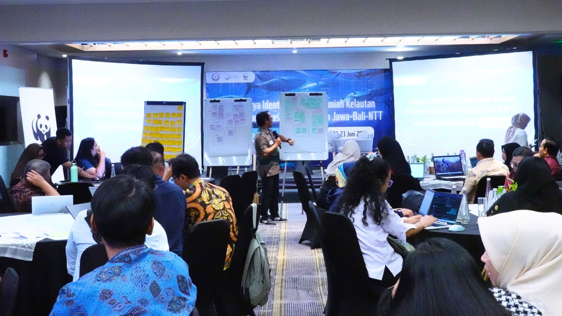
As a follow-up, the participants agreed on a number of priority steps, ranging from identifying data and scientific research needs, taking inventory of available data, to strengthening collaboration among stakeholders. It is hoped that the results of this workshop will serve as a foundation for developing a roadmap for LSMPA development in the regions of Southern Java, Bali, and NTT, supported by robust scientific data and sustained collaboration.