UNITED IN ACTION TO INITIATE A CONSERVATION AREA NETWORK
It is undeniable that Indonesia is an archipelago that has a high diversity of marine resources. However, our resources are threatened by destructive fishing activities, such as the use of bombs, potassium, trawling, etc. One of the steps taken by the Indonesian government to maintain sustainability in terms of ecology, economy and culture is to target the establishment of 20 million hectares of conservation areas by 2020.
The Ministry of Marine Affairs and Fisheries (KKP) supported by WWF-Indonesia and Nusa Dua Reef Foundation conducted an initiation phase, which analyzed the gaps of coastal and small island conservation areas in the Lesser Sunda seascape region. Out of 36 conservation areas with a total area of 4,826,569.79 Ha spread across Bali, East Nusa Tenggara and West Nusa Tenggara, 26 conservation areas have been assessed. The results of the analysis show that some locations of conservation areas in the Lesser Sunda seascape are more than 20 Km away so that they fall into the isolated category.
A conservation area can be said to be ecologically interrelated if it has a distance of around 15-20 km, while if a conservation area has a distance of more than 20 km from other conservation areas, it is categorized as isolated. Of the isolated areas, 9 of them have turtle habitat protection sites that still need to be improved management, and need complementary data for the final result stage of ecological gaps including secondary data on important habitats, habitats, and important protected species, socio-cultural and economic, and activities that threaten biological resources.
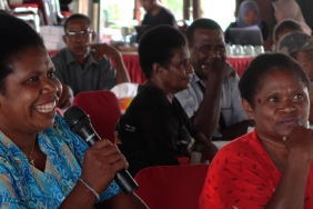
The results of the analysis were presented at a workshop entitled 'Overview and Gap Analysis of Coastal and Small Island Protected Areas in the Lesser Sunda Seascape'. The workshop took place over 2 days on January 26 & 27, 2015 at the WWF-Indonesia Office in Denpasar, Bali, and was attended by 24 people from local and national government and NGOs.
This ecological analysis study was conducted using the principles of marine protected area networks, namely 1) representation and management of important habitats, 2) protecting critical areas and areas that have high levels of biodiversity, and 3) a minimum distance of 15-20 Km between each conservation area by following the pattern of fish movement. a
Recognizing the vastness of Indonesia's waters and the interconnectedness of conservation areas in one seascape, the Ministry of Maritime Affairs and Fisheries issued Ministerial Regulation No. 13/2014 on the Network of Marine Protected Areas. Articles 6 and 7 describe the stages of establishing a network of marine protected areas at the local and national levels, namely 1) Initiation; 2) Public consultation; 3) Joint agreement; 4) Cooperation agreement; and 5) Socialization.
The next phase of the Ministry of Marine Affairs and Fisheries together with WWF-Indonesia will hold a public consultation which is planned to be held on February 23-24, 2015 in Bali by inviting management units and related agencies. This follow-up workshop is expected to produce a technical agreement on the need to manage conservation areas with networking.
To date, Indonesia has 15.7 million hectares of conservation areas, which slightly misses the 2015 target of 16.5 million hectares. However, not only the establishment of the target, but also the effective management of the area is also promoted by the Indonesian government. The results of measuring management effectiveness using the Evaluation of Coastal and Small Island Conservation Area Management (E-KKP3K) in accordance with the Decree of the Minister of Maritime Affairs and Fisheries Number 44 of 2012 are as follows: 30.7% of conservation areas have red status; 22.3% of conservation areas have yellow status; 23% have green status and 30% have no information.
Author: Amkieltiela - Marine Science and Knowledge Management Officer


