THREE PROVINCES SIGN ROADMAP TO INITIATE MARINE PROTECTED AREA NETWORK
The need to manage marine protected areas by networking in the Lesser Sunda Seascape has reached a mutual agreement with the signing of the Roadmap for the Establishment of a Marine Protected Area Network between the Directorate of Conservation of Fish Areas and Species - Ministry of Maritime Affairs and Fisheries (KKJI-KKP) with the Technical Implementation Unit (UPT), Marine and Fisheries Service (DKP) and the National Park and Natural Resources Conservation Center (BKSDA) under the scope of the Directorate General of Forest Protection and Nature Conservation in the provinces of Bali, East Nusa Tenggara, and West Nusa Tenggara.
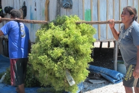
The signing of this Roadmap was carried out at the Workshop on the Establishment of Marine Protected Area Network in the Lesser Sunda Seascape Region organized by WWF-Indonesia and KKP on February 24, 2015, at Werdhapura Village Center, Sanur, Bali.
The Ministry of Marine Affairs and Fisheries supported by WWF-Indonesia and Nusa Dua Coral Reef Foundation conducted an initiation phase, which analyzed the gaps of coastal and small island conservation areas in the Lesser Sunda Seascape region. Of the 36 conservation areas in the region, 26 conservation areas with a total area of 4,826,569.79 Ha spread across Bali, East Nusa Tenggara and West Nusa Tenggara have been assessed.
The follow-up workshop was attended by representatives of UPT and related agencies from the provinces of Bali, East Nusa Tenggara and West Nusa Tenggara, including the West Bali National Park Center, Komodo National Park Center, KSDA NTB, Kupang National Marine Conservation Area Center (BKKPN), BPSPL Denpasar, Representatives of Marine Protected Area Management Units that have been and will be established such as SAP Pantar Strait, MPA Flotim, Nusa Penida Marine Tourism Park, Buleleng and Jembrana Fisheries Service, Bali Provincial Office, West & East Lombok Fisheries Service, and other partners including Wildlife Conservation Society, Coral Triangle Center, Conservation International and The Nature Conservancy.
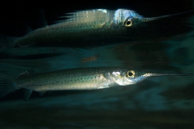
Nets in Lesser Sunda
The high biodiversity in Indonesian waters is not only caused by a very strategic geographical location but also influenced by several factors such as seasonal climate variations, currents or sea water masses that affect water masses from two oceans, as well as the diversity of habitat types and ecosystems contained therein.
Recognizing the vastness of Indonesia's waters and the interconnectedness of conservation areas in one seascape, a network that is managed jointly and in synergy between regions to achieve ecosystem balance and ensure the livelihoods of coastal communities.
The Small Sunda Seascape Marine Protected Area Network is a linkage between 36 marine protected areas that have critical habitats and areas that have high levels of biodiversity and a minimum distance of 15-20 Km between each conservation area by following fish movement patterns.
The establishment of a network of marine protected areas has been regulated in Ministerial Regulation No. 13/2014 on the Network of Marine Protected Areas. Articles 6 and 7 describe the stages of establishing a network of marine protected areas at the local and national levels, namely 1) Initiation; 2) Public Consultation; 3) Joint Agreement; 4) Cooperation agreement; and 5) Socialization.
Writer: Dynta Munardy - WWF Indonesia Website Writer