MAPPING PROTECTED AREA POTENTIAL IN TANIMBAR ISLANDS, WEST SOUTHEAST MALUKU
By: Frederik Peter Alan Batkormbawa(Yamdena MPA Representative, WWF-Indonesia Inner Banda Arc Subseascape)
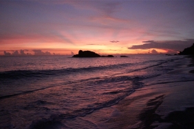
West Southeast Maluku (MTB) is at the southeastern tip of Indonesia's border with Australia and Timor Leste. The regency consists of 113 island groups, with a water area reaching 80.94% of the total area of 52,995.20 km2dan (BPS MTB, 2014).
Located in the golden triangle belt of the world's coral reefs, MTB's oceanographic conditions are rich in fish resources and other marine potential (Alansar et al., 2016). This potential is supported by the high density of mangroves on the coasts of the island.
Fishery products such as sea cucumber, lola, shrimp, squid, grouper, mackerel, lobster, crab, clams, snapper, sakuda, skipjack, and seaweed are commodities for this district.
CFR is part of the Ten Island Cluster in the regional development strategy of Maluku Province. ETP animals such as turtles, dugongs, manta rays, sharks, dolphins, and whales make CFR a feeding area and migration route to Australia, Papua, and the Pacific Ocean.
To maintain the sustainability of these natural resources, the KKP3K-TPK of West Southeast Maluku Regency was reserved through West Southeast Maluku Regent Decree Number 523-246 of 2016. The reservation of the MTB Regency KKP3K-TPK supports the Indonesian government's commitment to make Maluku Province a National Fish Barn (LIN) and the national achievement of 20 million hectares of conservation areas by 2020.
To achieve this target, WWF-Indonesia Inner Banda Arc Subseascape (IBAS) also supports the CFR Government to identify potential water areas for conservation in CFR.
The criteria of the area must protect the feeding habitat of ETP biota, and protect traditional use and local wisdom. This identification is done through surveys supported by literature studies and spatial analysis.
This survey produces data on ecological conditions, village profiles, marine resource utilization, and governance. After that, the data will be converted into spatial data analyzed using Marxan and Zonae Cogito decision support system software to identify locations that have high biodiversity value.
Marxan helps select protected areas with high biodiversity value at low management cost. While Zonae Cogito helps modify the scenarios that have been run by Marxan (Watts et al. 2011).
"From the results of Marxan's analysis of the study area, the best recommended protected areas are Wermaktian, North Tanimbar, Yaru, South Tanimbar, Wertamrian, and Wuarlabobar sub-districts," explained Andreas Hero, WWF-Indonesia's Project Leader for the Inner Banda Arc Subseascape (IBAS).
The high potential of fishery products, unique and natural ecological conditions, the large number of islands, and easy access that facilitates monitoring efforts; are the reasons for the selection of these 5 sub-districts.
The total area of the Marine and Island Conservation Area - Small Island Park (KKP3K-TPK) of West Southeast Maluku Regency recommended by WWF is 783,806 hectares, with the conservation objective of protecting 30% of critical habitats.
"The challenge in the future is the problem of supervision and public awareness. People already know a lot, but we must continue to provide an understanding of conservation," said Ir. V. Batlayeri, Head of MTB Fisheries Service. "Without conservation, in the next few years, our fish will all be gone," he added.
The proposed area for the MTB Regency KKP3K-TPK is quite extensive. Hopefully, the 783,806 hectares can provide space for protection and legal certainty in the utilization of coastal and marine waters.