THE LONG JOURNEY OF WAKATOBI ZONING REVISION
By Sugiyanta
The efforts to improve and revise the conservation activities in the region are sometimes adjusted to certain conditions and situations. For example, expansion of territory, or sometimes from the dynamics of the community that continues to grow. The journey of regional growth of Wakatobi National Park (TNW) had also gone through such process from 1995 until 2007 when a revised zoning of the region was legitimized. Someday, when necessary and need to be adjusted, it is possible to revise the zoning again.
In the beginning, Wakatobi islands were part of Buton district administration. In 1996, the government appointed an area of 1.3 million hectares as TNW. Then it splits off and becomes a district authorized by the law (definitive) on 18 December 2003; thus, the area and boundaries of the national park are equal to the area of the district administration. Therefore, the previous design of marine (zoning) spatial, when it is still part of Buton district administration, should be reorganized because the functions and purposes are no longer effective.
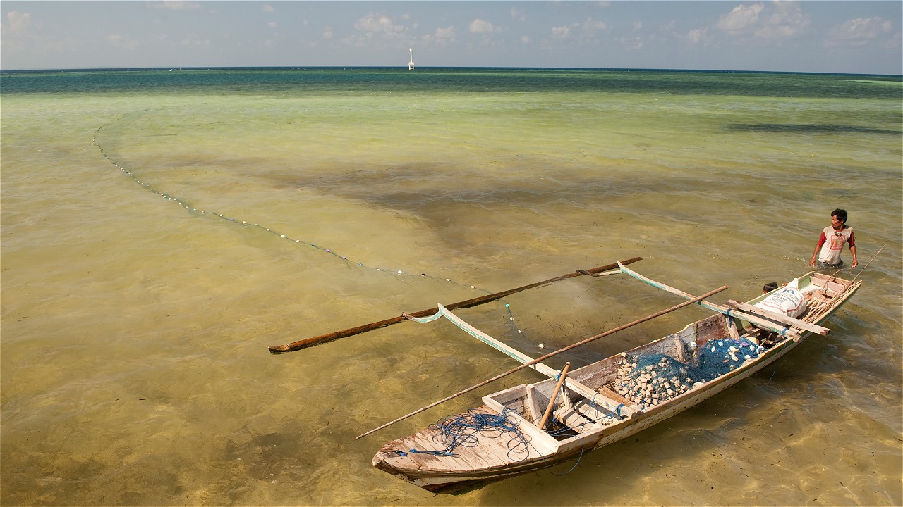
The process of TNW zoning revision is held through the stages of building a perception of national park management, monitoring the resources, assessing the effectiveness of TNW conducted by an independent team from the government, the Indonesian Institute of Sciences (LIPI), and universities (Bogor Institute of Agricultures/IPB and Haluoleo University/Unhalu). The next stage is compiling the survey results of the area biophysical resource monitoring with information from people’s experiences which produces the location map of important biological resources and the location map of area utilization. The information from the public is about the important locations that they know based on their experience; and the locations of resources use, which include the utilization types and the users through two activities namely direct monitoring on the sea and discussions held by the members at the house, group, hutment, village, sub-district, island, and district. This process had started from 2005 to 2007. The map of important resources and area utilization is returned to the community to be discussed by the elements of household, group, hutment, village, sub-district, island, and district in order to consult the selection of information in the map that needs to be protected according to the community.
The results of map discussions are brought to public consultative forum at the island level. The forum is attended by representatives of village fishermen, community leaders, heads of villages, Village Councils (BPD), sub-district administrations, relevant regional government agencies such as Marine and Fisheries Office, Tourism Office, Public Works and Transportation Office, Planning Agency (BAPPEDA), and the elements of TNW Office, military (Koramil), and police (Polsek). The consultation result is in the form of zoning map design based on the aspiration from each island, which is then brought to the consultative forum at the district level for discussion. In addition to the document as the result, the island-level consultative forum also recommends people who will become the representatives of the islands during the district-level consultation forum. The representatives consist of elements from Sub-district Leadership Council (Muspika), village administration representatives, and fisherman representatives.
The map draft resulted in the district-level public consultative forum is given to the TNW Office and the district administration for consultation with the stakeholders at the national level. The result of the national consultation is returned back to the region for the second stage of consultation starting from the village, island, and district. The final result is brought to the national consultative forum which will produce an agreement between the national government and Wakatobi district administration, signed by both parties.
The stages of TNW zoning revision process are briefly explained as follows:
- Hutment-level meeting at 190 points in March 2004 with a discussion topic on area management; and discussion journal sheets as supporting tools. The result of the meeting was the hutment-level meeting journal containing the overview of dominant issues in the community and the information from individuals who were always dominant during the discussion in each hutment, and the name list of the hutment leaders for discussion at the village level.
- From August – December 2004, a series of workshops at the village, sub-district, and district levels were held. The workshops resulted in the issues that would be fought by the islands at the district-level meeting; collaborative management planning; capacity building planning for the representatives of fishing communities; zoning revision plan, joint patrols plan, recommendations on people’s economic empowerment; a plan to establish consultative forum at the island.
- January 2005: the establishment of island facilitators in January 2005. The facilitators are responsible for facilitating the meetings of consultative forum, facilitating capacity building for fisherman representatives in the consultative forum, facilitating with the capacity building partners from The Nature Conservancy (TNC) and WWF.
- From February – July 2005: village-level discussions, island-level (sub-district) workshops to establish island consultative forum and the mechanism of the forum.
- The next stage is the regular meetings of district-level consultative forum; capacity building training on the mechanism of the forum; forum activities in improving the capacity of fishermen; encouraging collaborative management; zoning revision which involves the community; forum regular meetings; island forum regular meeting once every three month; district forum regular meeting three times every year; and independent forum.
- In August 2005, the district-level regular consultative forum was held. The results were the mechanism of the forum; forum activities in improving the capacity of fishermen; encouraging collaborative management; zoning revision which involves the community; island forum regular meeting once every three month; district forum regular meeting three times every year; and independent forum.
- Capacity building training was held in Hoga Island in December 2005. During this training, the participants formed the fishermen groups/group revitalization with three indicators: common regulations, shared assets, aspirations and activities for the same profession.
- From April – September 2005, people’s opinions were compiled in Marxan document (mapping software) containing the important resources in 64 villages. This meeting resulted in the protection methods through undisturbed protection zone, establishing checkpoints, and restricting fishing gears without closing the area.
- Zoning public consultation at the island level (a combination of sub-districts, because each island has expanded into two sub-districts) in four islands started in Binongko, Tomia, Kaledupa, and Wangi-Wangi which were held from October – November 2005. The results of the consultation were: agreeing not to make the map but to make the zone criteria first; conserving the resources and not disturbing people’s lives, as well as selecting the representatives for district-level workshops.
- In December 2005, a district-level public consultative forum was held and the result of the plenary was a draft of zoning map.
- A consultative forum at the national level was held in February 2007 and resulted in the revised zoning map.
- From March – April 2007, the second stage of public consultation meetings were held at the village/hutment, island/sub-district, and district levels. The results of the meetings were the approved map and the planning of signs installation, dissemination of revision results, installation of boundaries markers, and the formation of zoning information post at the village/hutment level.
- In 2007, a national-level public consultation was also held in July 2007. The result of the consultation was the signing of zoning revision by the Regent of Wakatobi and the Director General of Forest Protection and Nature Conservation (PHKA).
Currently, TNW has adopted the new zoning system (see the image comparing before and after) in accordance with the provisions of the zoning designation. The current homework is to ensure the monitoring, supervision and implementation of the zoning from the lower level up to the top. And as mentioned at the beginning of this article, the needs to revise the zoning in the future will always be made possible when necessary, depends on the situation which is based on the evaluation conducted every 3-5 years.
Wakatobi is considered unique due to the region’s marine biodiversity as well as the scale of reef condition that makes Wakatobi the highest priority of marine conservation in Indonesia. At least four species of marine sea turtle are identified in this region, including green and hawksbill turtles. Beside sea turtles, there exist around 396 coral sceleractanian species, 31 fungia species, 31 foraminifera species, 34 stomatopods, and up to 942 fish species. This priceless biodiversity has brought successfully Wakatobi to its formalization as a Marine National Park in 1996. The WWF’s long and persistent work has been fully supported by USAID-CTSP, DANIDA (Danish International Development Agency), WWF-Netherland, and in collaboration work together with The Nature Conservancy (TNC).
Contact:
Sugiyanta, WWF Project Leader Site in Wakatobi National Park, sugiyanta@wwf.or.id
