EAST NUSA TENGGARA TO STUDY DESIGN OPTIMIZATION OF MARINE PROTECTED AREAS FOR SUSTAINABLE FISHERIES
By: Muhammad Erdi Lazuardi (Project Leader for Lesser Sunda, WWF-Indonesia)
"East Nusa Tenggara (NTT) is one of the provinces with the largest marine protected areas (MPAs) in Indonesia. Our province has 10 MPAs with a total area of 4.4 million hectares," said Mr. Agustinus Bulu, Secretary of the NTT Marine and Fisheries Agency (DKP) that day (27/2). He was opening a series of workshops held by WWF-Indonesia on optimizing MPA network design for sustainable fisheries at Hotel Naka, Kupang, February 27 - March 3, 2017.
"The Indonesian government targets 20 million hectares of MPAs by 2020, of which currently about 17.8 million hectares have been achieved. Thus, NTT contributed 24.7% of the national achievement," he continued.
An MPA is built to manage marine resources sustainably through three pillars: biophysical - a well-maintained ecosystem; socio-economic - benefits for the community; and institutional governance. Fisheries and tourism activities - can be managed without putting the ecosystem in danger.
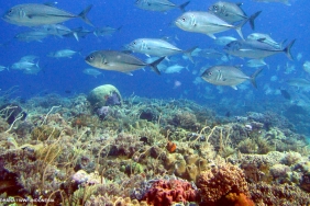
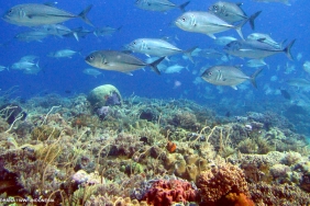
This MPA design optimization training is a series of WWF-Indonesia's agenda to explore more advanced MPA designs, so that they can function optimally in promoting sustainable fisheries. This includes MPAs in East Nusa Tenggara, which falls within WWF-Indonesia's working area in the Lesser Sunda Sub-seascape, the heart of the Sunda Banda seascape within the World Coral Triangle.
The training participants came from various agencies, such as the NTT Provincial Aquatic Conservation Council (DKPP), NTT Provincial DKP, NTT Provincial Bappeda, NTT Provincial Tourism Office, NTT Provincial Transportation Office, NTT Provincial Natural Resources Conservation Center, NTT Provincial Regional Environmental Service, PSDKP Kupang, and NTT Provincial Spadu.
In addition, the NTB Provincial DKP, DKP and Bappeda of Alor, East Flores, Sikka, and West Manggarai Regencies, Komodo National Park Center, Kupang National Marine Protected Area Center, Denpasar Coastal and Marine Resources Management Center Wilker Kupang, The Nature Conservacy (TNC), and academics from Nusa Cendana University, Artha Wacana Christian University, Muhammadiyah University, and Kupang State Agricultural Polytechnic were also present.
In this training, participants learned about spatial and non-spatial modeling that can support MPA design. This is important for policy makers, spatial planners, conservation area managers, and researchers directly involved in marine spatial and marine protected area design activities.
With a combination of learning methods such as public lectures, practice, discussions, case studies, and computer practice, participants are expected to apply new methods to optimize connectivity between MPAs through fish larval dispersal and practice the basics of MPA design and networking based on spatial analysis.
"MPA design must be formulated appropriately, for effective and sustainable protection and utilization of marine resources," emphasized Mr. Izaak Angwarmasse from DKP NTT, closing the six-day 'Spatial Planning for Marine Protected Area Design in Indonesia' training. "After this, a periodic forum is needed to share information and solutions for MPA networking and management, in accordance with KP Regulation No. 13 2014 on Marine Protected Area Networking," he continued.
Indeed, conservation is not to prohibit, but to ensure sustainable, environmentally friendly utilization, with respect for customary management. Coastal and small island communities are the key stakeholders of conservation. They are not objects, but subjects who contribute to the management of marine conservation areas in this country.